Roxy and Linda's Bicycle Blog
7th posting on June 18, 2013 ..... Back to the welcome page and listings for other links
Day
8 - Prineville, OR to Mitchell, OR - 48
miles ... 275
total miles
Headed out of Prineville in the sunshine. Rolled through beautiful
ever changing countryside, ranches and hayfields with lots of irrigation, forests
of Ponderosa Pine and wild flowers. We climbed
again, 32
miles to Ochoco Pass and whizzed down thru mountains, rocky bluffs, distant fields
and more ranches. We're spending the evening in Mitchell, population 200, in the
Oregon Hotel, built in
the late 1800's
that has been beautifully renovated. Met Mel, from Michigan, riding from Astoria,
OR to Yorktown, VA, the Adventure Cycling Trans America Trail (TA).
Day
9 - Mitchell, OR to Mount Vernon, OR - 60
miles ... 335
total miles
Had breakfast with Mel and met Jez from the UK who is riding
the TA. Rode out of Mitchell with raincoats on and started climbing 6
miles to Keys Pass, we had rain and then fog about 3
miles from the top and down the other side. Didn't see much until the fog cleared.
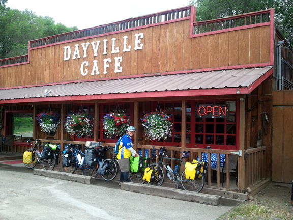
Wound down thru forests and canyons into the John
Day River Valley. Jez & Mel passed us, we caught up with them at the Dayville
Cafe. After lunch we rode on to Mount Vernon where we're staying at a dumpy hotel.
Met up with a group of gals from Eugene on a week ride looping around from Prineville.
The sag crew invited us to dinner with them. We met one of them, Sue, on the ride
down Mckenzie Pass. Fun evening! Oh, also met 2 guys riding the TA east to west
on the road today, they were so pumped about their rides, started 72 and 80 days
ago!
Our email address is gusrox30@gmail.com
. Feel free to drop a note and say hello anytime!
This
is the Adventure Cycling map we used for the Oregon segment of the TransAmerica
Trail. |
Keyes
Creek Summit in the rain |
Welcome
to Dayville, pop. 138 |
Lunch
stop @ the Dayville Cafe. We caught up with Mel & Jez, cyclists |
Lunch
on a cattle grate. |
Ochoco
Summit. |
Any mistakes or corrections, email me at coachellis@cox.net | |